Operational Hydrology
Flood & River Flow Forecasts
for Canada
10-day streamflow forecasts (today + 9 days) at over 300 modelled river gauges, and live observations from over 900 gauges across Canada. Powered by AI-developed hydrological models and machine learning.
 Example
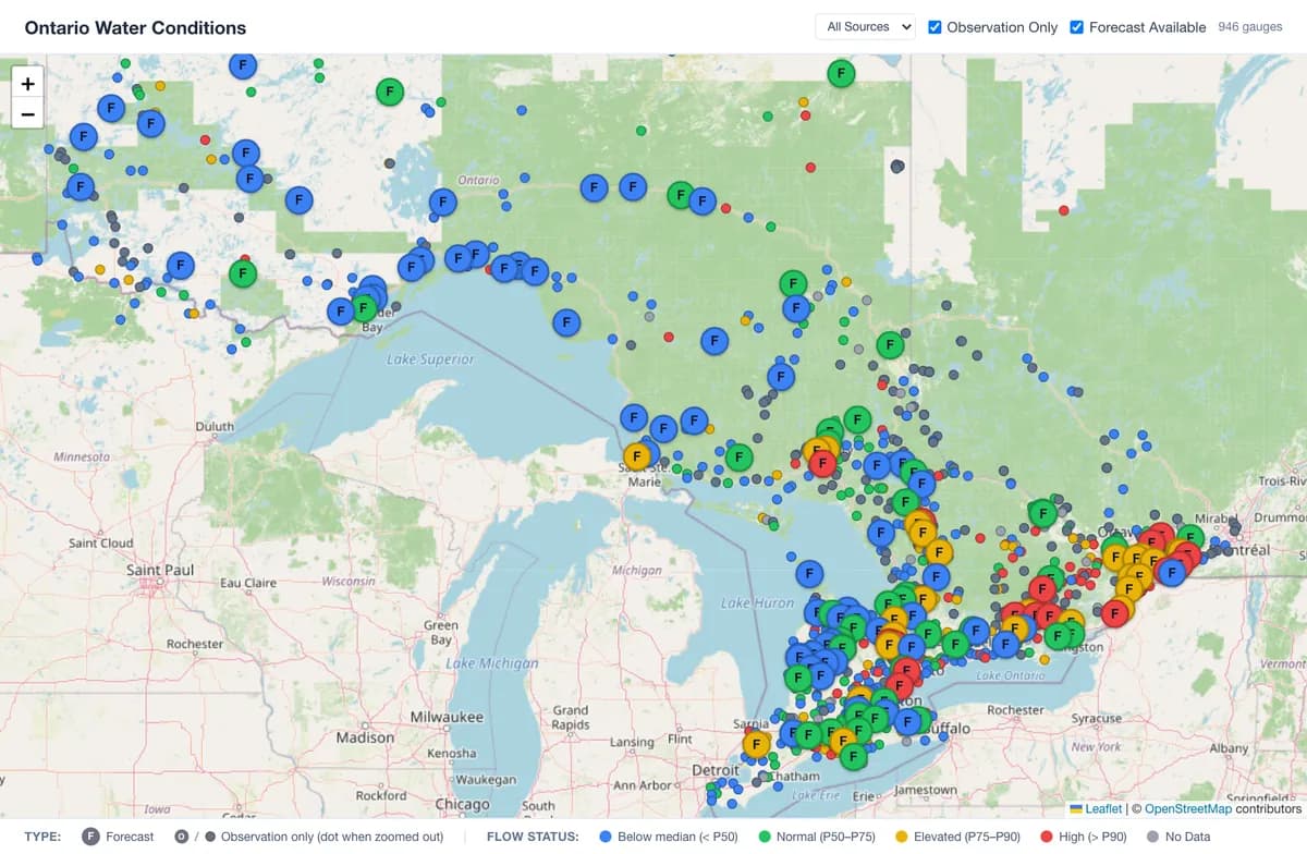
Interactive Water Conditions Map
See the gauges we track across Canada at a glance. Gauges with enough history are coloured by how current flow or water level compares with the historical median and upper percentiles for the date, and you can filter to the gauges that have a forecast.
Streamflow Forecasts
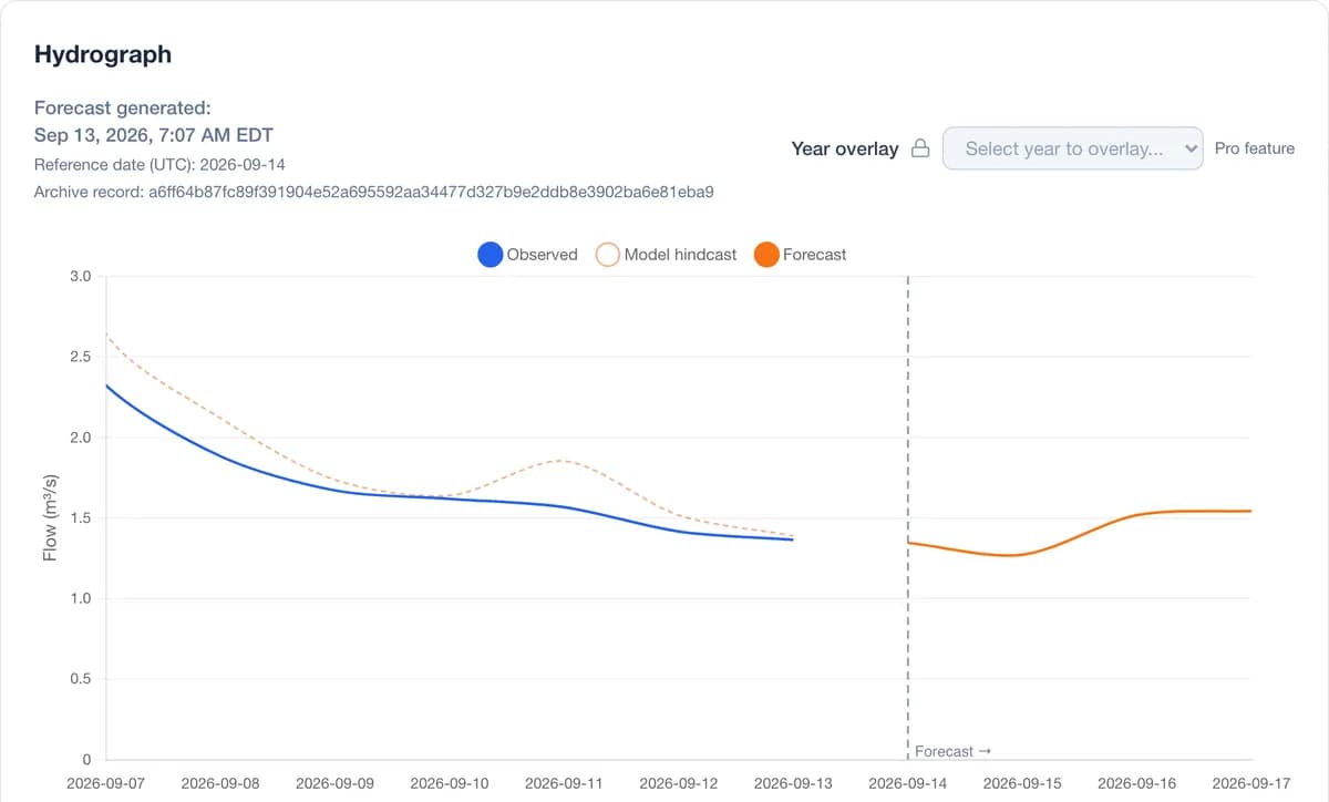
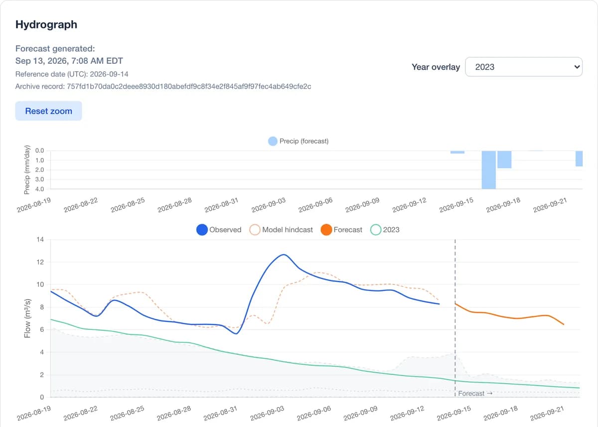
Streamflow forecasts at over 300 modelled river gauges. Pro gives a 5-day forecast with flow values, in 6-hour blocks, on the gauges you unlock; Commercial gives 10 days (days count today). Zoom and pan the hydrograph to compare with recent observed flow. Level forecasts are available at gauges with a published rating; elsewhere water level is observed only.
 Example
 Example
Historical Context
On gauges with enough history, see current flow against the shaded P10–P90 range for the date, over the full observed record. Overlay any year since 1996, where available, to compare this season with, say, 2023. Free for everyone.
Basin Weather Forecast
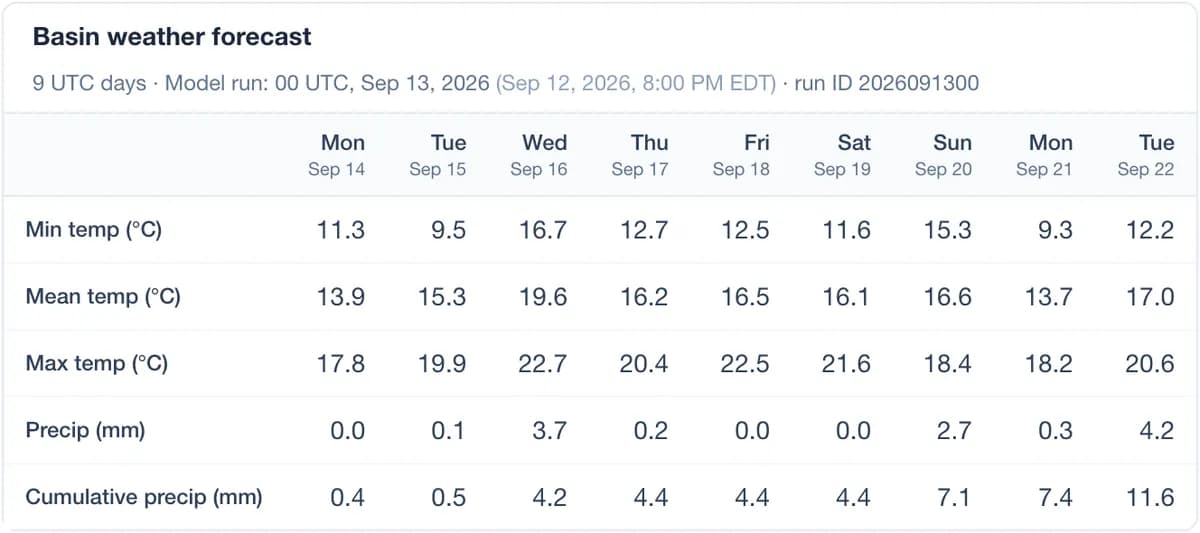
Up to 10 days of basin-average precipitation and temperature for each modelled gauge, from Environment and Climate Change Canada weather models. Free for everyone.
 Example
Free vs Pro
Pricing will be set based on adoption during the free trial, which runs through the 2027 freshet.
| Feature | Free | Pro |
|---|---|---|
| River forecast (modelled gauges) | — | 5-day forecast with flow values, in 6-hour blocks |
| Observed history on screen | About 2 water years plus the current one | About 2 water years plus the current one |
| Favorites & dashboard | Unlimited | Unlimited |
| Email alerts | Observed levels, on your favorites | Observed levels and forecast, on gauges you unlock |
| Map colour vs historical median and upper percentiles | Included | Included |
| Historical range (P10–P90) on hydrograph | Included | Included |
| Year overlay | Any year since 1996, where available | Any year since 1996, where available |
| Basin weather forecast | Up to 10 days | Up to 10 days |
| Compare past forecasts | — | Last 7 days |
Built on open government data
Observations and weather inputs come from public agencies, and gauge pages show when each forecast was generated.
Water Survey of Canada
Real-time and historical streamflow observations from the national hydrometric network.
Learn moreEnvironment Canada (ECCC)
Numerical weather prediction fields including precipitation and temperature forecasts.
Learn moreAgentic AI-developed hydrological models
Physically-based watershed models calibrated by AI agents, enhanced by machine learning post-processing.
Learn more